


POPULAR DESTINATION
MYANMAR HIGHLIGHT DESTINATIONS
Myanmar sits at the crossroads of Asia’s great civilisations of India and China, and looks out onto the vast Indian Ocean next to Thailand. One of South East Asia’s largest and most diverse countries, Myanmar stretches from the sparkling islands of the Andaman Sea in the south right up into the Eastern Himalayan mountain range.
To this day Myanmar remains one of the most mysterious and undiscovered destinations in the world. A land of breathtaking beauty and charm yet only recently emerging into the modern world. What can the casual visitor therefore expect upon arrival, and why should one embark on such a journey in the first place?
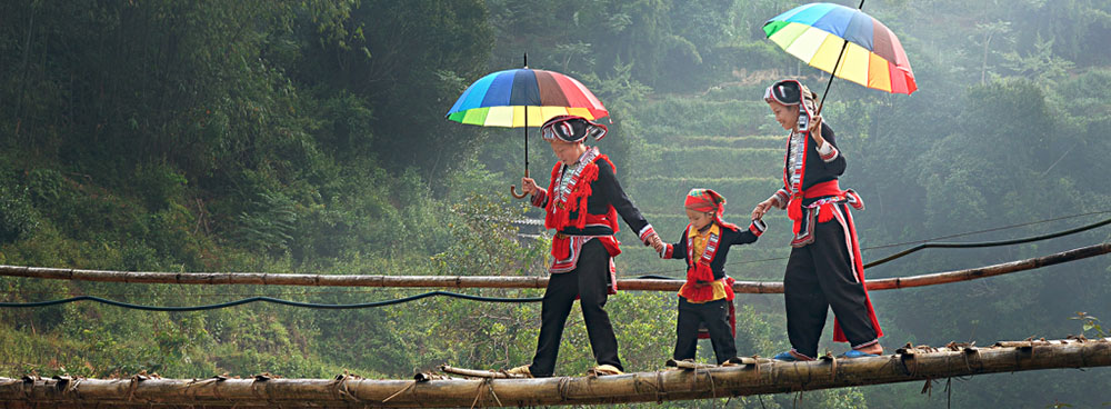
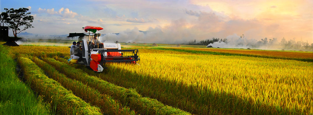
Myanmar offers all the traditional delights of Asia in one fascinating country. Virgin jungles, snow-capped mountains and pristine beaches, combined with a rich and glorious heritage spanning more than two thousand years. Spectacular monuments and ancient cities attest to a vibrant culture that is still home to 135 different ethnic groups.
The country’s tourism infrastructure boasts five star properties, intimate boutique hotels and family guest houses in all the major centers, as well as stunning mountain and beach resorts. Myanmar also boasts one of the lowest tourist crime records in the world, so visitors can rest assured their holiday will be carefree from start to finish.
Wherever you go in Myanmar, whether it be cruising down the mighty Ayeyarwaddy River in style, drifting over the ancient city of Bagan by hot air balloon, or searching for that elusive tiger on the back of an elephant, there is always a feeling of adventure. With two modern internal airlines upgrading and expanding their networks, new and exciting destinations off the beaten track are gradually being opened. From mountain trekking and rafting in the far north to world class diving in the Mergui Archipelago. But above all, Myanmar offers the warmest welcome in Asia.
YANGONYangon is the cosmopolitan and the main business city of Myanmar. Also known as “The green city of the East”. Yangon has been in existence for a long time, founded by King “Alaungpaya” in 1755. Yangon means “End of strife”. Population is over five millions and the city is beautiful with colonial buildings, wide tree-lined streets and tranquil lanes. The Shwedagon is the most conspicuous landmark visible from miles around and it is the most sacred of all Buddhist sites in the country for Buddhist people. Other places of interest are Sule pagoda “The heart of city”, Bogyoke Aung San Market also called Scott Market and China Town.
Kyaik-hti-yo “Golden Rock” is a sacred, massive gold –leafed boulder delicately balanced on the edge of a cliff at the top of Mount Kyaik-hti-yo. It was built in the year 574 BC more than 2500 years ago and now well know as Miracle Golden Rock and which starting at pilgrim-village and first we take the truck and then walk for one hour up the hill are unforgettable experience in your trip to Myanmar.
Bago, formerly call Pegu is a city and the capital of Bago Division in Myanmar It is located 50 miles (80 km) from Yangon. It is just about an hour drive from Yangon. Bago is accessible easily from Yangon, Mandalay, Pyay and other cities. According to legend, two Mon princess from Thaton founded Bago in 573 AD. Most interested places are Shwethalyaung Reclining Buddha (55 meters long), Shwemawdaw Pagoda, and 28 meter high huge Buddha Image of Kyaikpun Pagoda with its four huge Buddha Images facing the cardinal points and the one interest place is Kanbawzathardi Palace.
Thanlyin (Syriam) is located across the Bago River from the city of Yangon. It’s across the Yangon River via Thanlyn Bridge built by Chinese engineers. Thanlyin Township comprises 17 quarters and 28 village tracts. It is home to the largest port (Thilawa) in the country. In the 15th century as the main port city of the Hanthawaddy Kingdom In 1599, the city fell to the Rakhine forces led by the Portuguese mercenary Felipe, who was made governor of the city. Thanlyin became part of the British Empire in 1852 after the Second Anglo-Burmese War. The city's population has increased from 43,000 in 1983 to 123,000 in 1996.Interested places are Ancient Portuguese Church (AD 1749 – 1750).Kyauk Tan (Yele Pagoda-A floating Pagoda which is Pagoda on a small island in the middle of the river).
The Htaukkyant World War II Cemetery, also called the British War Cemetery, is one of the biggest cemeteries in Myanmar. In the cemetery are the graves of some 27,000 Allied troops killed in the World War II campaign in Burma. Htaukkyant Cemetery is located slightly outside the town of Htaukkyant (also written Taukkyan) about 15km north of Yangon, on the way to Bago. In the Htaukkyant World War II Cemetery is Today the Imperial War Graves Commission maintains the grounds. The neatness of the manicured grass and well-planted flowering shrubs seems to set the cemetery apart from the rest of Myanmar. It is a place for contemplation, to discover silence and solitude.
Twante canal is connects the Irrawaddy River and the Yangon river in Myanmar. The 35-km (22-mile) canal is a heavily used short cut between the city of Yangon and the Irrawaddy Division. The canal is named after the town of Twante, located near the canal's mid-way point. The town of Twante is located on the banks of the Twante Canal. It is mainly known for the pottery that it produces. The quaint and decidedly rustic city has a very 'frontier town' feel to it, particularly given the two-wheel horse carts that can be seen ferrying passengers along its dusty streets, and the numerous stilted wood and thatched bamboo huts that surround (and are sometimes interspersed in between) the older stucco building of the city. It is possible to reach the city from Rangoon by boat, taking the Twante Canal from the Rangoon River downstream from the main jetty.
The capital of Mon State is the third largest city in Myanmar. Mawlamyine is situated 165 kilometers east of the nation's capital across the Gulf of Mottama at the mouth of the Thanlwin River with a population of almost 300,000 people. Kyaik-Than-Lan Pagoda, Kyaikkami Yele Pagoda. Setse Beach, Thanbyuzayat "death railway", making it a fascinating place to visit!
Hpa-An is the capital of Kayin State. Recently removed from the restricted list of travel destinations. Possible to reach it by road from Yangon across a new Bridge (Thanlwin) over the Thanlwin River. Hpa-an is small town but busy commerce center you can see farmer coming to town in horse carts or trishaws stacked with baskets to sell in the market. The population is about 50,000 people are most of are Kayin.
Bagan is the richest archaeological sites in Asia. The ruins of Bagan city cover an area of 42 sq. km embracing over 2000 ancient pagodas and temples. The enchanting city is located in the tropical zone of the country, on the eastern bank of the Irrawaddy River about 193 kilometers south east of Mandalay. Bagan shows Myanmar architectural heritages from the 11th to mid 14th centuries.
Getting here: It is a 1 hour 10min direct flight from Yangon; 30 mins direct flight from Mandalay; and 1 hour, usually via Mandalay from Heho.
Mt. Popa is an extinct volcano which 1518 meters (4981 feet) above sea level, and a day trip from Bagan, set amid lovely hill and forest scenery. The Popa Taungkalat Shrine is home to 37 Mahagiri Nats, or spirits. Statues depicting the Nats are at the base of the Shrine. From the top of Taung Kalat, one can enjoy a panoramic view of the ancient city of Bagan.
Pyin Oo Lwin offers visitors cool days and nights, peaceful rural roads and tracks for walkers and cyclists, trekking in the fruit and flower producing countryside, and interesting shopping. Old times can be re-lived with coach rides, and many historical and beautiful places are within easy reach. Just over an hour's drive from Mandalay, Pyin Oo Lwin is an ideal and refreshing destination for visitors to Upper Myanmar. Lashio which is trading town in Northern Shan State , accessible by road from Mandalay-Pyin Oo Lwin. From Lashio, the famous Burma Road, built by the British before the War, intersects with Ledo Road leading into the Yunnan Province. Crossing over historic Gokehtaik Bridge, it’s a fascinating journey to Lashio and its famous for Natural Hot- Spring.
Monywa, about 136 km to the west of Mandalay, a major center for trade and commerce for agricultural product from surrounding Chindwin Velly. Mohnyin Thambuddhei Paya, it dates from 1303, although it was reconstructed in 1939. It is said to contain over 500,000 images of Buddha. Giant reclining Buddha at Bodhi Tahtaung (one thousand Bo Tree) Shwezigon-Paya, Aung Setkya Paya, and Phowintaung are major places for the visitors.
The second largest city and the capital of the last Myanmar Kingdom is in central of Myanmar, 688 km north of Yangon on the bank of the Irrawaddy River. The city remains many monasteries and pagoda with conservative tradition and the lifestyle of own culture. Also well know for its traditional arts and crafts, ivory, wood, marble, and stone carvings, gold and silver ware, hand woven silk and tapestry called (shwe chi htoe).
Getting here: It is a 1 hour 15min direct flight from Yangon; 30 mins direct flight from Bagan; and 25 mins direct flight from Heho.
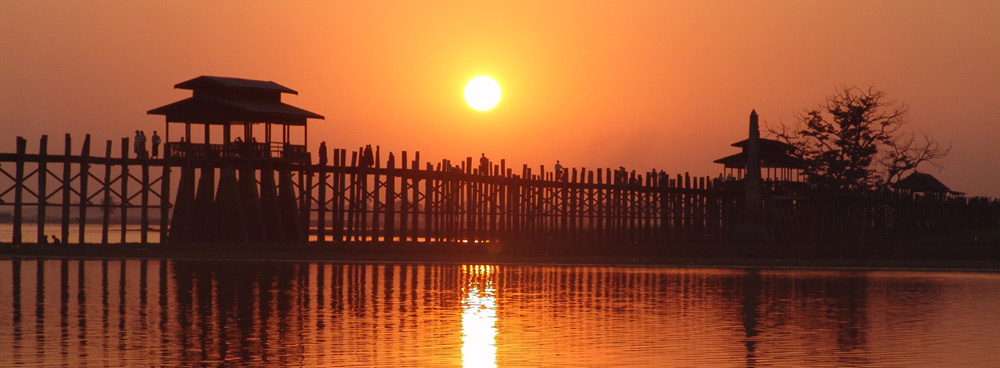
The name means City of Deathlessness, but its period as capital was brief. It was founded by Bodawpaya as his new capital in 1783. Being 7 miles (11km) sough of Mandalay, Maha Gadayon Monastery, Bagaya Kyaung Monastery and U Bein’s wooden bridge are the famous destination for traveler. Ava: Innwa (Ava) located on an island between the Irrawaddy and Myitnge Rivers. We visited Ava by horse cart (bullock cart).The ruins of a brick and stucco monastery called Maha Aungmye Bonzan (Okkyaung) is the main site.
The hilltops, each crested with a pagoda, the banners proclaiming the Buddha's teaching, the refuge from all ills and tribulations where over 600 monasteries for monks and nuns are located for Buddhist studies and meditation. Its side by Irrawaddy River and across the Inn-wa Bridge which is British-engendered 16 span bridges that dates to 1934, as was the only structure crossing the Irrawaddy River until 1998.
Mingun is located on the western bank of the river Irrawaddy River about 7 miles north of Mandalay. The main attraction is the Mya Theindan Pagoda and ruined Pathodawgyi, a Buddhist temple with the remains of a massive stupa begun by King Bodawpaya in 1790. The temple was not completed, because an astronomer claimed that the King would die when the temple was finished. Mingun Bell, A gigantic bell weighs 90 tons, and is today the third largest bell in the world. Mingun is famous for many Buddhist shrines, monasteries, meditation centers and monuments of historical and cultural importance.
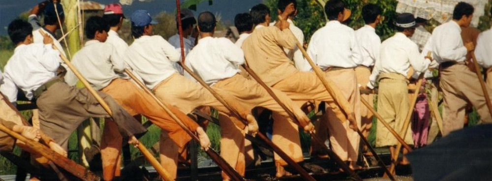
Inle Lake is one of the most beautiful lakes of Southeast Asia. Lush, green and fertile, remote Inle Lake is a picture of rural tranquility. As it lying 875 km above sea level at Shan State. The lake is nearly 100 km north to South but only 5 km wide and there are more than200 village on or around it, surrounding a population of about 150,000 most is Intha People. Sagar (Sankar) the second lake: you can observe of local rice mill factory, making bullock cart wheels. Pristine culture and traditional life-style of the ethnic groups of Pa-O and Intha inhabited around Sankar
Getting here: A 1 hour 15 min direct flight from Yangon; 1 hour flight usually via Mandalay from Bagan; and a 25 mins direct flight from Mandalay.
Kalaw is a former colonial British hill station on the western edge of the Shan Plateau in Myanmar. Kalaw is located 70 km west of Taungyi, about halfway along the Thazi-Taungyi road and sits at 1,300 meters elevation. Kalaw is cool during the day and cold at night. There are many hiking trails amid gnarled pines and bamboo groves. Palaung Tribe Village is famous for trekking. At first a steep track leads down into a narrow valley where the Palaung cultivate cheroot, tea, damsons and mangoes on the hill.
Pindaya is situated at 1164-m above sea level and is 40-km from Kalaw. Its famous for its extensive limestone caves which overlooking the Pindaya Lake and Shwe U Min Paya which is full of Buddha images of about 8000 and picturesque Boutaloke Lake. Pindaya. There are many big banyan trees lined up at the base of the Pindaya hill, Hgnatpyawtaw, a Danu village, is at the end of these trees and it is most attraction of visitors.
Kyaing Tong lies in the valley between the high misty mountains of the Shan Plateau and the Mekong and the Thanlwin Rivers. It is the home of the Gon, Lwe, Li, Wa, Lah Hu, Thai Nay, Shan, Li Shaw, Li Su, Palaung, Akha, and we can only differentiate the tribes by colorful dresses which is different to one another. As Thai-Myanmar border, visitors are allowed to cross into this border town with Border Passes. Kyaing Tong is fomous for eco-tourism activities like trekking, mountain-biking and adventure tours.
PUTAO: Northern part of Myanmar and famous for snow-capped mountain. Around year are cold and pleasant weather. Flora and Fauna can be seen in the forest around Putao. Mt. Khakhaborazi (5889 metres), which is the highest mountain in Myanmar and in Southeast Asia. It’s attractive for adventure trekking, mountain-climbing and hiking around PutaO and some tribe’s village.
Getting here: Air Bagan flies to Putao during the cool dry season from October to April. It is a 4 hour connecting flight from Yangon to Mandalay then stop over at Myitkina and then to Putao.
As the capital of Northern Part of Myanmar and border trade canter with China. It is the extreme northern terminus of a railroad line from Yangon, and formerly an important town on the Ledo Road. In Myitkyina Myanmar’s great Irrawaddy River is combining of Maikha and Malikha Streams at Myitsone. The water over there is crystal clear. Myitkyina is famous for Jade mine which is about 148 km west of Myitkyina, there is a place called “Hpa Kant”, which is home to the best jade mine in the world.
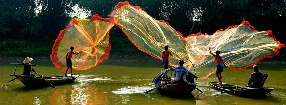
Bhamo is a city in Kachin State in Myanmar, located 186 km south from the capital city of Myitkyina. It lies on the Irrawady River, and is the nearest river port to the Chinese border. The district covers an area of 4146 sq. m., and the population in 1901 was 79,515. It is mainly composed of Shan-Burmese and Kachins. It is an offshoot from the latter of these ridges that forms the third defile of the Irrawaddy between Bhamo and Sinbo. The serenity of it self is pleasant to cruise along Irrawaddy River.
Nat Ma Taung, also known as Mount Victoria. It’s located in Kanpalet Township, Mindat District, is part of the Chin Hills range, and rises to 3,053 metres (10,016 ft) above sea level. Which can observe the traditional and cultural heritage of Chin people and their living systems, the natural forest flora, bird watching and wildlife tours, hiking, mountain-climbing, observe of 159 bird species including 5 indigenous species, a very rare species of rare birds which can be found only in Myanmar Forest. Also observe of Mammals such as tiger, bear, wild boar, leopard, guar, gibbon, etc. and 159 bird species, reptiles and butterfly are present. It covers an area of 279 square miles and forests include hill evergreen, moist upper mixed deciduous , pine forests (above 9000 feet), and hill savannah.
Sittwe is the capital of Rakhine State and the port city of Sittwe sit at the month of the Kaladan River emptying into the Bay of Bengal. The 2006 population 181,000 and it is the provincial capital. Viewpoint is perhaps the most well known attraction in Sittwe. It is at the end of the Strand Road and looks out into the Bay of Bengal and the mouth of the Kaladan River. Shwe Zaydi Kyaung, Pyay-lone-chan-thar Payagyi (Atulamarazein), is one of the most sacred Buddhist pagodas, believed to have built in the days of Emperor Asoka (r. 269-232 BCE). Rakhine Cultural Museum which contains exhibits on Rakhine culture and history.
Mrauk U is an archaeologically important town in northern Rakhine, Myanmar. It lies east of the Kaladan River, and is surrounded by hills in the north and south. In 1431, King Min Saw Mon established Mrauk U as the capital of the last unified Arakanese Kingdom. An important trading port with links to Portugal, the Netherlands, Arabia, Persia and India. The city eventually reached a size of 120,000 in the mid sixteenth century. There are five temple and five pagoda are worthy religious buildings in and around the town. Mrauk U can rightfully be claimed as the "Open-air Museum" of the arts and culture of the people of Rakhine.
Ngapali Beach: Lies on the Bay of Bangle and south west of Myanmar on the Rakhine coast. It’s only seven kilometers stretch of coconut palm lined, soft sandy meeting of the land and sea. It is half and hour flight from Yangon.For those who love the 5 star sea, sand, sun, swim and snorkeling, visit to Ngapali is must.
Ngwe Saung Beach: Ngwe Saung Beach, the newest beach destination in Myanmar is situated 48 km from Pathein in the Ayeyarwaddy Division, about 190 km from Yangon on the western seaboard of the country, facing the Bay of Bengal. The beach stretches 15 km of white sand, blue sea, untouched surrounding and you can enjoy the pristine sea.
Getting here: Currently there are no flights from Yangon to Ngwe Saung. The town is only accessible by road from Yangon which takes about 5- 6 hours depending on size of vehicle and road conditions. But there is also a 25 mins flight from Yangon to the city of Pathein and then a 1 hour transfer to the beach.
Mergui Archipelago, is far southern Myanmar (Burma), comprises over 800 beautiful islands. It consists of more than 800 islands, varying in size from very small to hundreds of square kilometers, all lying in the Andaman Sea with an amazing diversity of flora & fauna and very beautiful underwater scenes and marine life. This makes Mergui Archipelago very famous for the best Diving in Myanmar. The only human inhabitants in the area are sea gypsies, namely Salone in Myanmar. They are main attraction for international tourists as well as to operate marine eco-tourism around the islands in Myeik (Burma) Archipelago.
LOCATION
Myanmr, also known as Burma, is the largest country by geographical area in Indochina is bordered by China, Laos, Thailand, Bangladesh, India and the Bay of Bengal to the south-west with the Andaman Sea defining its southern periphery. One-third of Burma's total perimeter, 1,930 kilometers (1,199 mi), forms an uninterrupted coastline.
GEOGRAPHY
Myanmar, which has a total area of 678,500 square kilometers (262,000 sq mi), is the largest country in mainland Southeast Asia, and the 40th-largest in the world. It is bordered to the northwest by Cittagong Division of Bangladesh, Manipura, Nagaland and Arunachal Pradesh of India to the northwest. It shares its longest borders with Tibet to the north and Yunnan of China to the northeast for a total of 2,185 kilometers (1,358 mi). It is bounded by Laos and Thailand to the southeast. Burma has 1,930 kilometers (1,200 mi) of contiguous coastline along the Bay of Bengal and Andaman Sea to the southwest and the south, which forms one quarter of its total perimeter.
CLIMATE
Myanmar has a largely tropical climate with three seasons: the monsoon or rainy season, from May to October; the cool season, from November to February; and the hot season, generally from March to April. Rainfall during the monsoon season totals more than 500 cm in upper Myanmar and over 250 cm in lower Myanmar and Yangon (formerly Rangoon). Central Myanmar, called the dry zone, and Mandalay, the chief city in the area, each receive about 76 cm (30 in). The climate in upper Myanmar, particularly at altitudes ranging from about 300 to 1,220 m, is the most temperate throughout the year, while lower Myanmar, especially in the delta and coastal regions, is the most humid.
PEOPLE
Myanmar is a union of 135 ethnic groups with their own languages and dialects. The major races are Kachin, Kayah, Kayin, Chin, Mon, Bamar, Rakhine, and Shan. The name Myanmar embraces all the ethnic groups.
POPULATION
Population of the country is estimated at 52.4 million (July, 2003) and it is going to be 60 million soon. The population growth rate is 1.84 percent. Roughly three quarters of the population are rural inhabitants, with the remaining population living in urban Yangon, Mandalay and Moulmein. About two thirds of Myanmar's population is Burman (ethnically close to Tibetans and Chinese) with other minorities making up the other third.
RELIGION
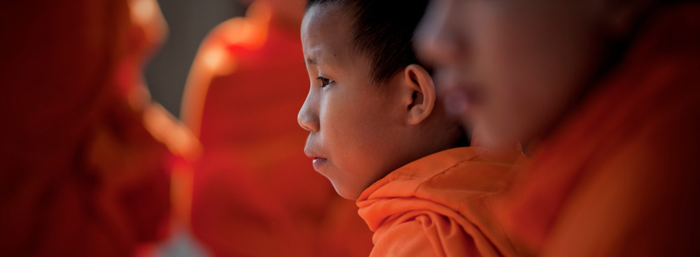
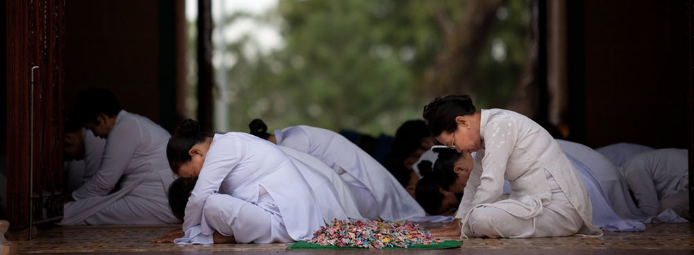
Myanmar is a predominantly Buddhist country with Buddhism of the Theravada school being practiced by nearly 90 per cent of the population. Other religions practiced in Myanmar are Christianity (6 per cent), Islam (4 per cent), and Hinduism (nearly 1 per cent).
TIME ZONE
Myanmar’s Standard time is UTC+0630 of GMT.
CURRENCY
The Myanmar Kyat is the currency in Myanmar (Burma, MM, and MMR). The symbol for MMK can be written K. The Myanmar Kyat is divided into 100 pyas.
VISA & PASSPORTS
A valid Passport with Entry Visa is required of all visitors. A Tourist Visa allows a stay of 28 days, extendible for an additional 14 days. Visa application can also be submitted at Myanmar Embassy nearest to your location or can be obtained for Visa-On-Arrival.
AIRPORT TAX
Airport Tax is levied on all passengers leaving Myanmar on international flights: USD 10 payable at the Yangon International Airport. There is no airport tax on Domestic flights.